Creating AR worlds without boundaries using Geospatial
How we’ve been exploring the future of what’s possible in immersive experience.
At Bernadette we’re always looking to leverage new tech in creative ways in order to push innovation within the digital space. From AI prompt engineering to motion design, exploring the limitations of these disciplines is part of our process in building brand experiences that consistently bring that ‘wow’ factor.
That’s why a particular announcement at Google I/O back in May really caught our attention. The Google XR and Map team took to the stage to reveal something called Geospatial — a new immersive platform that has already given next-level creative freedom to designers across the globe, allowing them to build AR content in real-world environments with a new degree of universal accessibility.
Since that announcement we’ve already seen the game studio Taito celebrate the 45th anniversary of their arcade classic Space Invaders by reimagining it in glorious AR. Similarly, big brand power-combo Gap and Mattel also leveraged the technology with impressive results — using Geospatial to create an immersive Barbie tie-in experience that augmented New York’s Time Square with a not-so-subtle shade of pink.
And, not to be out done, virtual pop-art collective The Gorillaz took things a step further, using Geospatial to map a world tour of capital cities in which fans could immerse themselves in live music events centred around unique locations.
How it works, and why it matters
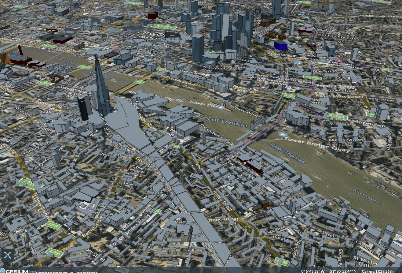
The Geospatial Creator tool is powered by ARCore coupled with the Google Maps Platform. It harnesses geospatial data — information that has a geographic aspect — to build bespoke Augmented Reality content using Photorealistic 3D Tiles.
These tiles are essentially detailed 3D models that are then anchored to the physical world using LAT and LONG coordinates. ARCore's technology understands the surrounding real-world environment, and overlays the virtual objects accordingly. Users can then view and interact with 3D models of buildings, landscapes, and other geographic features as if they were actually present within their physical surroundings.
The game-changing aspect of Geospatial is its ability to dispense with ‘markers’. Historically, AR applications have relied on predefined physical markers present in the environment to function — a logistic hurdle that Geospatial has been able to neatly sidestep using the emphatic acronym SLAM (Simultaneous Localisation and Mapping).
Additionally, Geospatial Creator means that AR experiences are no longer as dependent on the technical specifications of a users’ smartphone (a situation that has typically resulted in too many low-spec legacy devices having a drag on accessibility). Instead, developers are able to create objects in Unity or Adobe Aero, before world-anchoring them using real-time localisation, and publishing the AR experience to either web, Android or iOS app stores.
Now, unconstrained by AR’s previous technical limitations, immersive experiences can position themselves for a better universal uptake, and allows brands to scale their audiences quickly, on a lower budget.
Getting in the Zone with Geospatial Creator
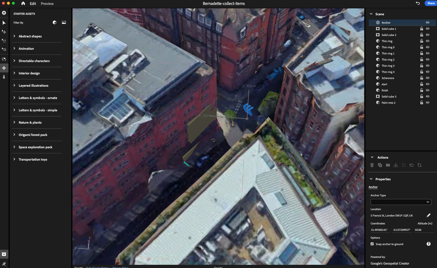
Seeing all this new potential, we decided to put Geospatial through its paces — using Sonic the Hedgehog as our inspiration. Working in Adobe Aero, the aim was to recreate Sonic’s Green Hill Zone in and around VCCP’s Greencoat House headquarters in London, and do it in a way that went beyond simply mapping objects to nearby buildings.
We wanted to really bring the classic video game experience to life and challenge users to ‘collect’ a multitude of Sonic-style rings scattered liberally around the site.
This design implementation helped to reveal a number of limitations along the way, and we needed to overcome these in order for the experience to be perfectly immersive. Specifically, we encountered a frustrating limitation in the form of some basic occlusion issues — and for a while we were scratching our heads, staring at golden rings that Adobe Aero should have been hiding behind solid brick and mortar.
The workaround came when we discovered we were able to simply mask our 3D rendered rings by creating a dynamic, invisible layer that covered them up whenever they were supposed to be obscured by these real-world objects.
The final result proved to be dynamite. We had created an audio-enhanced Sonic experience that saw users collecting rings simply by passing through them.
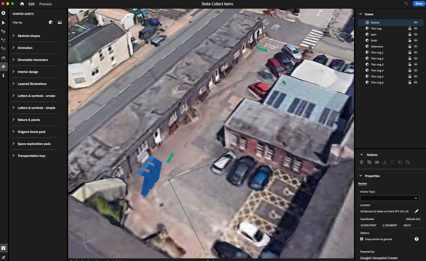
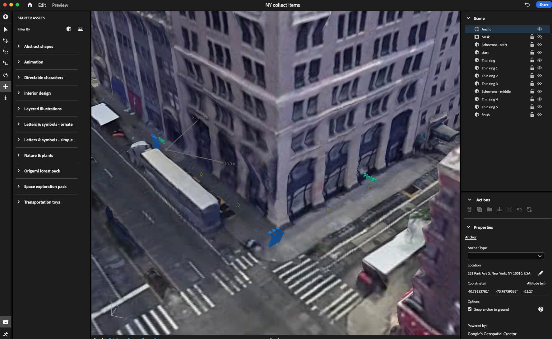
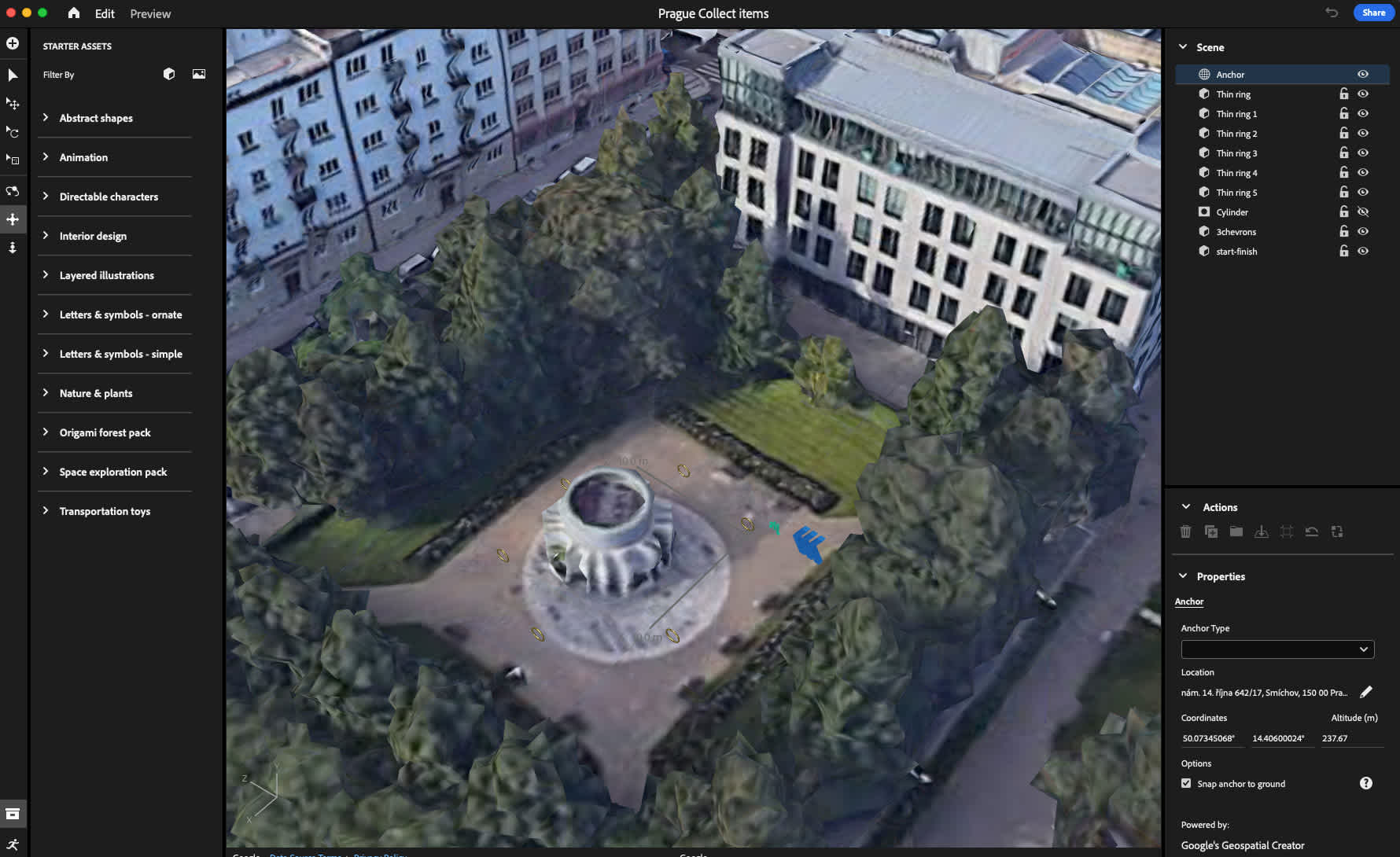
As an added bonus, Geospatial’s portability really proved its worth because we were able to then successfully transpose our data onto other real-world environments. This made it easy to relocate the game model to Bernadette’s other offices around the world — from New York, Prague, Madrid and Stoke!
Bringing it all together as a fully interactive mixed reality experience
So what’s next? We’ve always got our eyes on opportunities to leverage this technology and push it even further. We’re already thinking bigger — and assessing how we’d like to apply our combined Systems & Design thinking approach to a more broadly scoped city-wide adventure realised as an engaging, immersive experience.
ABOUT THE AUTHOR
NATE HULLEY | TECHNICAL PRODUCTION DIRECTOR
With over 20 years of experience in the advertising and marketing industry, I oversee the technical production of our comms campaigns, CRM development, and spearhead Bernadette’s immersive/XR offering.

Let's talk
Got a business challenge that’s looking for an innovative digital solution? Or, perhaps you’re interested in joining our collective of digital pioneers? Maybe you just want to know a little more about what we do. In any case, we’d love to hear from you.
